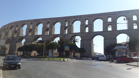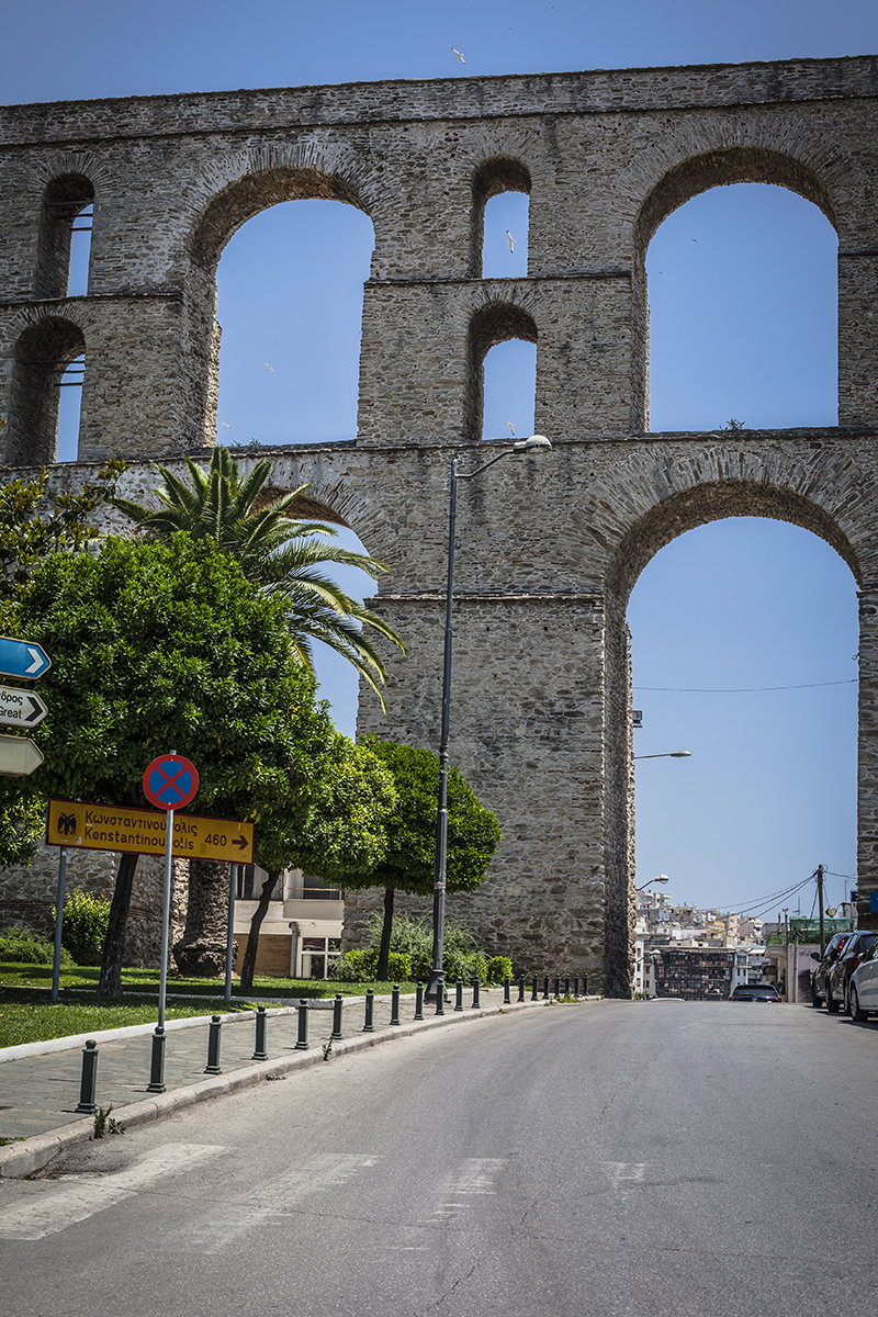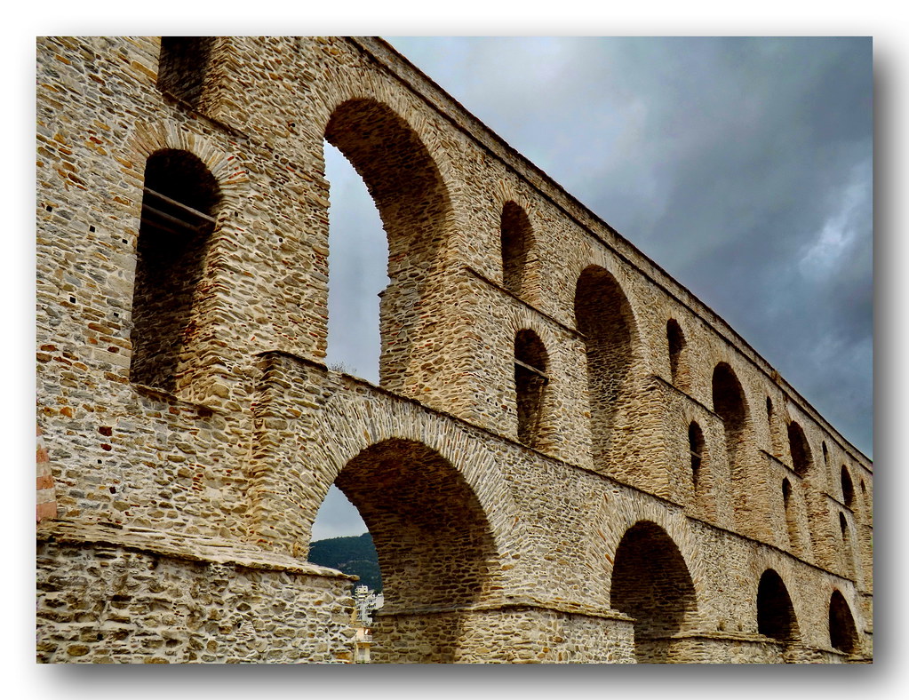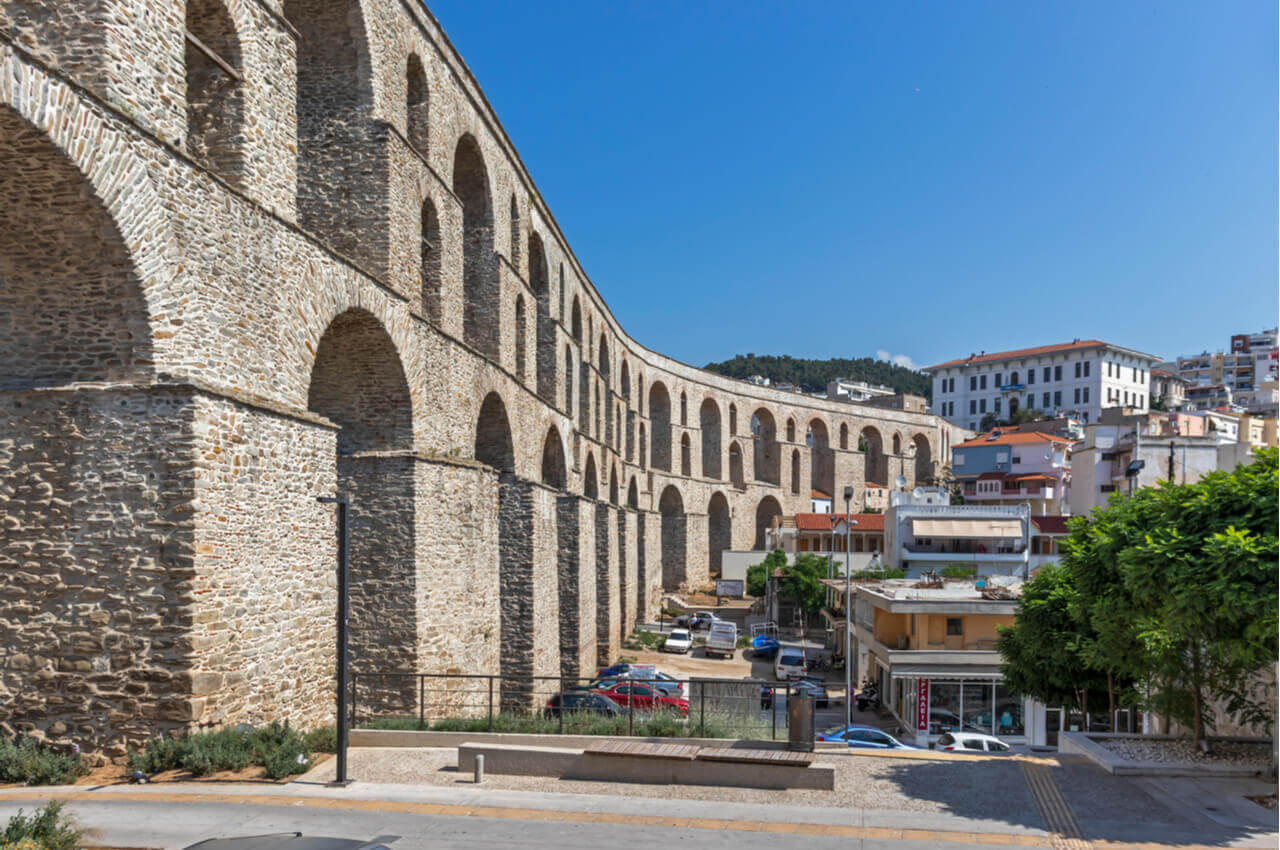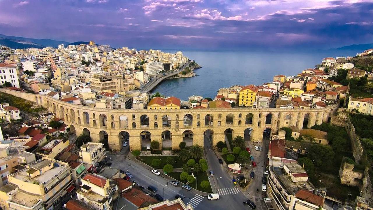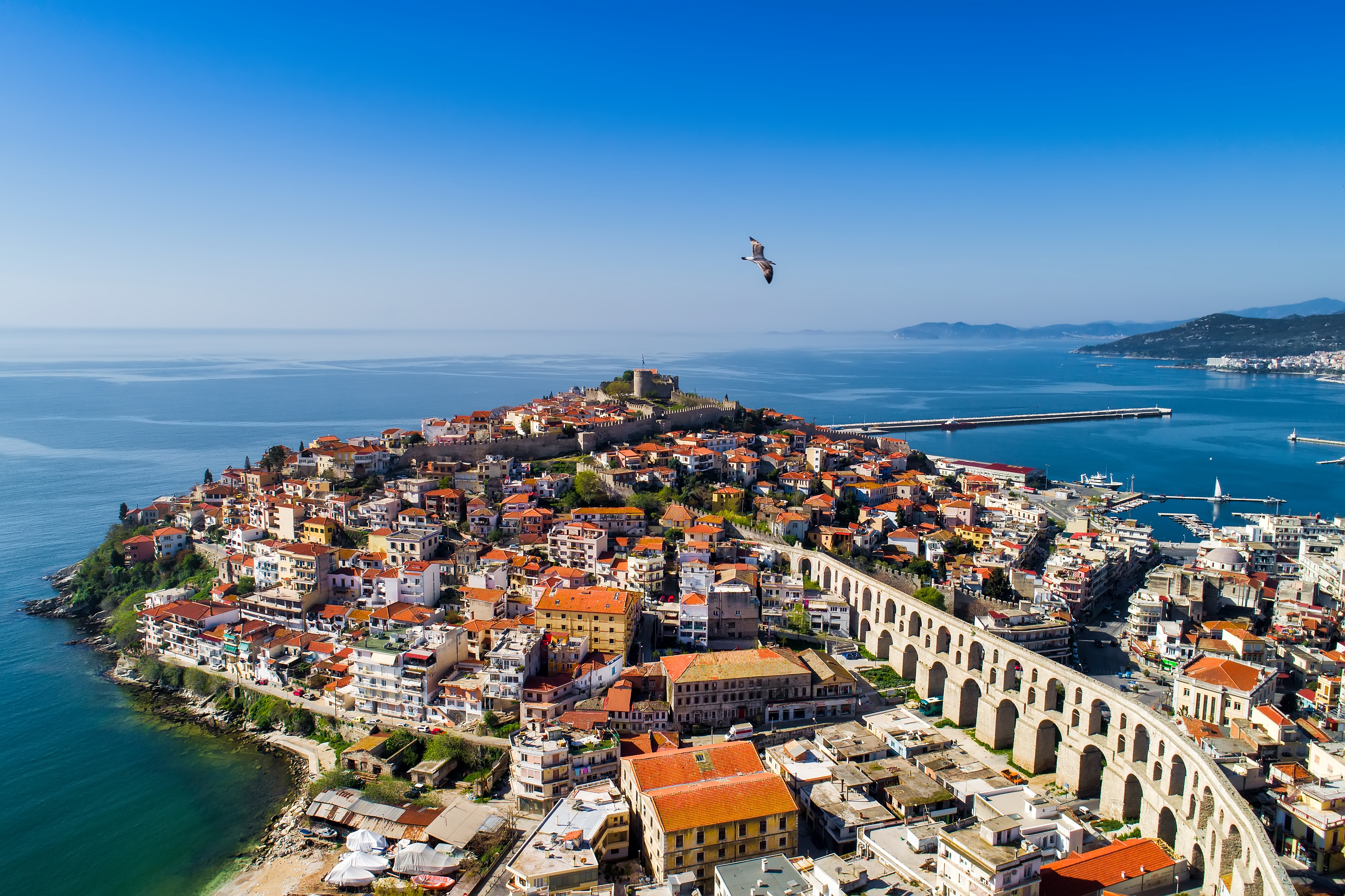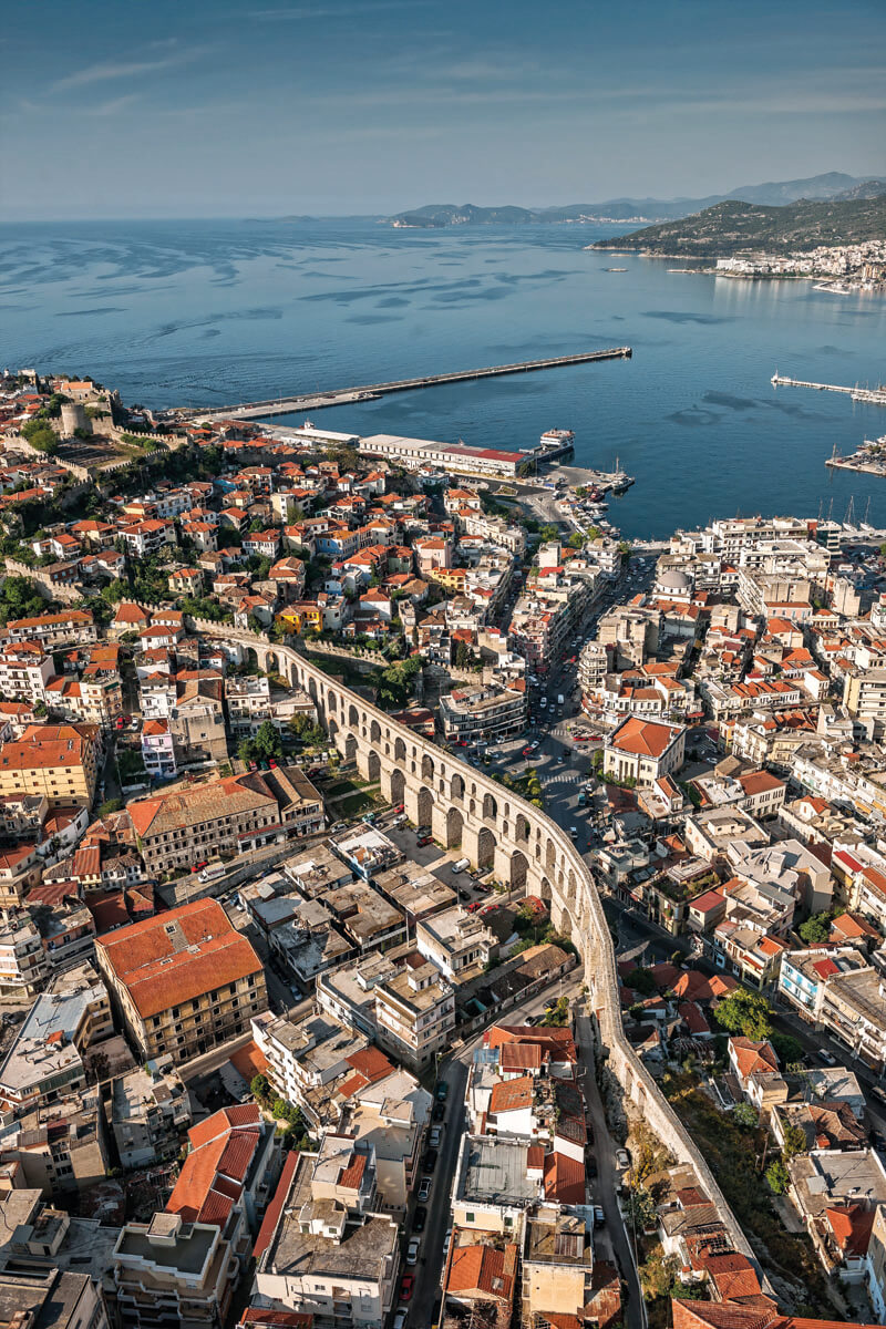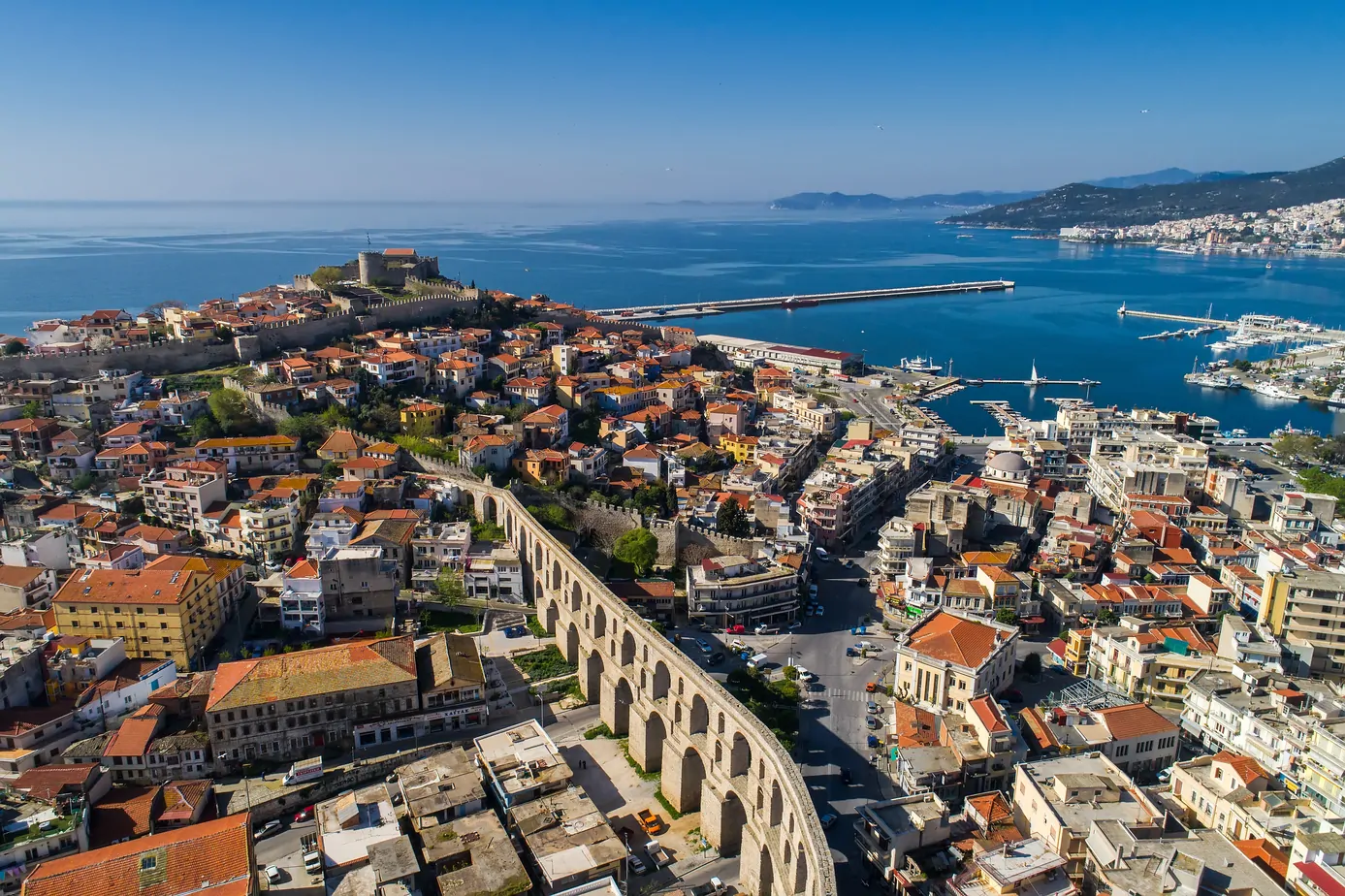
Kamares (the Old Aqueduct)
General descriptionTripadvisor: #3 attraction to the preferences of the visitors of Kavala.
Audio description: https://cutt.ly/GbEfyey
In the early 16th century, the arid peninsula of Panagia was supplied with water with the waters that spring from the area of Old Kavala. They were channeled to the city through a built ground pipeline 6.5 km long, which started from a spring located at an altitude of 400 m (known as "mana of water" or "Soumbasi" or "three Karagatsia") and ended in Kamares.
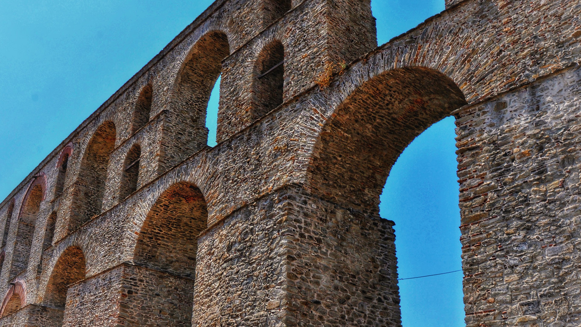
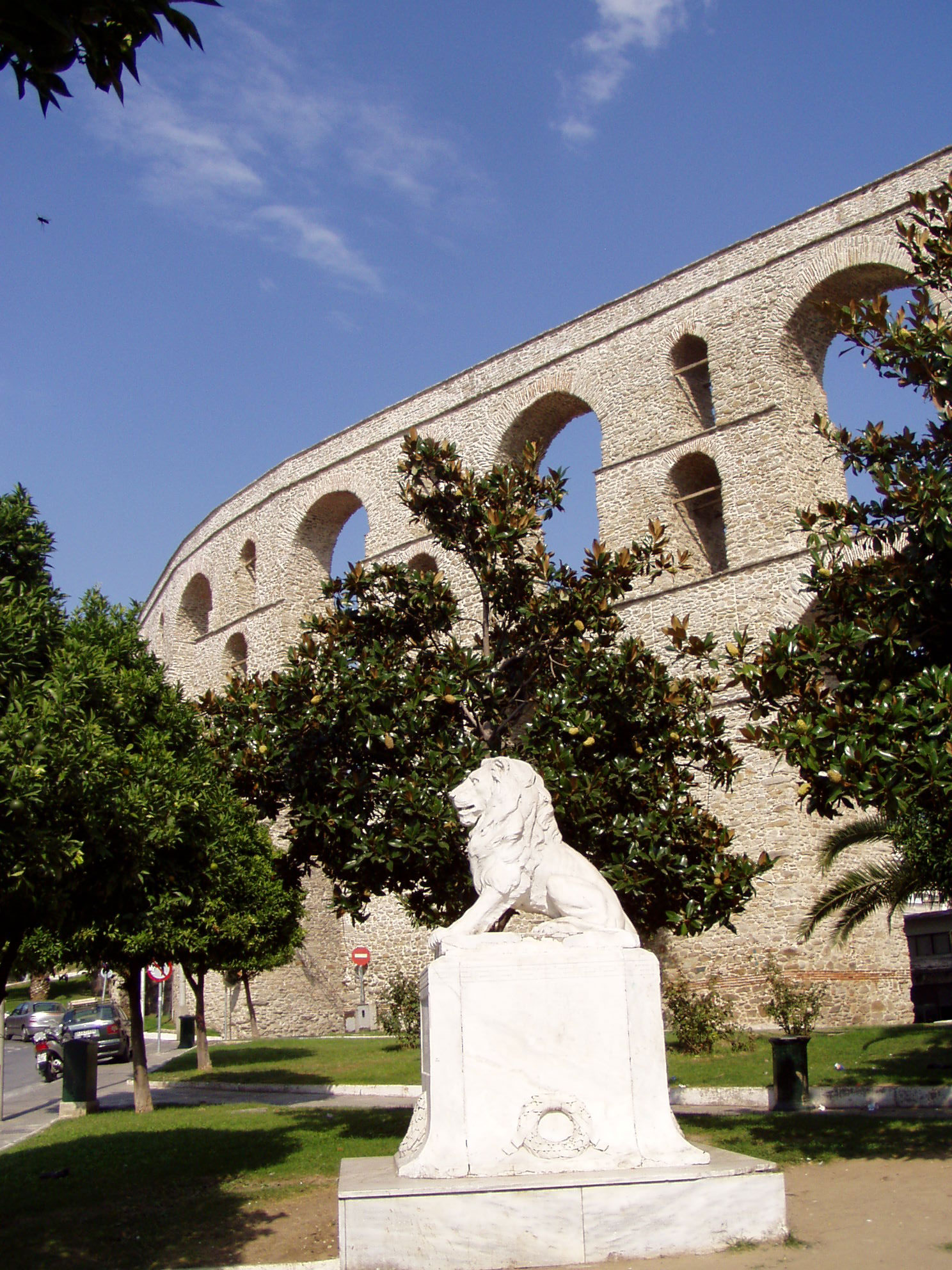
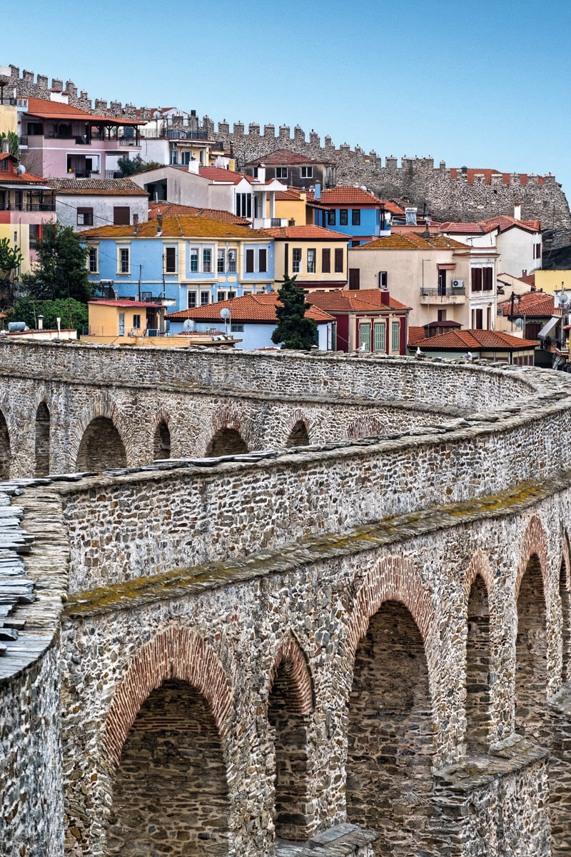
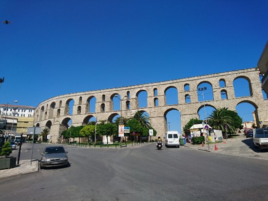
The most recognizable monument of Kavala has a length of 270 m. and a maximum height of 25 m., it is built of local granite and plinths. It rests on 18 massive mezzo-deepers (bases) and has a double and in some places triple series of successive arches. It was constructed to bridge the low part that separates the peninsula of Panagia from the opposite hills. So the water reached the public fountains (there are still three remains), the tanks, the baths and the institutions of the old town.
The Kamares were built by Ibrahim Pasha, vizier of Sultan Suleiman the Legislator, between 1520–1530, during the reconstruction period of the city and were a vital work. The water made the settlement viable, contributed to the development of its urban functions, the settlement of new residents and the great increase of its population. In short, it was a decisive factor for the transformation of Kavala from an insignificant settlement to a small town.
As a project it is huge, disproportionate to the size of the then insignificant settlement. A similar aqueduct of the Ottoman period, of such scale and such a strong construction, is not found elsewhere. It is therefore speculated that in the same area there was an aqueduct of an earlier period, on the remains of which the Kamares were built. More convincing is the view that kamares is the Roman aqueduct of ancient Neapolis. It was constructed during the first post-Christian centuries, between the 1st and the 6th, it received many repairs from time to time and must have maintained its original function at least until the middle Byzantine period.
In 1520–1530 the water pipeline was radically repaired throughout its route, from The Three Karagatsia to the city, the water bridges were built or repaired and in the place of the destroyed aqueduct the imposing Kamares were rebuilt. This old aqueduct watered the city of Kavala until the first decades of the 20th century. It was maintained in good condition for four centuries thanks to its continuous and systematic maintenance and occasional repairs.
In 1912–1913, the authorities of the temporary Bulgarian administration abolished centuries-old protective measures and turned the water trail into a road. The passage of pedestrians, herds and wagons caused damage and cracks in the pipeline, resulting in the loss of water and frequent infections. The city of Kavala, during the years of the settlement of the refugees, faced a huge problem of water supply. Its population increased excessively from 25,000 to 50,000 and there was no internal water supply network. The water reached the old town every other day and only for a few hours and the communal fountains became the scene of Homeric quarrels for the rare good. In the period 1914–1928, the city was tragically tested by the lack of water, which led to systematic efforts to address the problem.
In 1923, the engineer Nikolaos Michas was assigned a water supply study and in 1928 the new aqueduct of the city was constructed, with water abstraction from three new boreholes in the area of Tekir-Bounar, whose drilling took place in 1927 near a pre-existing one. This pre-existing drilling had been constructed as early as 1911, as a donation of the hadivis of Egypt to his hometown, in order for it to acquire the necessary aqueduct. From this location water was pumped with two diesel pumps.
In 1948, the Municipality of Kavala, at a distance of 150 meters from the original pumping station, installed two electric pumping units. So the situation has improved considerably. However, the lack of water was still severe.
Between 1957 and 1958 there was a decline in the water level of the boreholes. In order to raise the water level, the operation of the pumping station was often interrupted. Then the Municipality proceeded to the realization of two new boreholes, which saved Kavala from a water scarcity test, when in the years 1959-1960 in almost the entire summer season the automatic flow of drilling I. In 1961 the many rainfalls contributed to the restoration of the problem. However, it was now established that the aquifer area of Tekir-Munar was not sufficient, especially during the summer months. Thus began efforts to find new water resources.
In 1963, the civil engineer L. Cortesis was assigned a relevant study. According to this, two more boreholes could be exploited in the area of Amygdaleonas-Datos, a solution that is economically feasible for the capabilities of the Municipality of Kavala. In addition, full exploitation of the existing installation, which had the serious advantage of high automatic flow, would be achieved. However, the work, for unknown reasons, was not carried out and the problem of water shortage continued for a few more years.
In 1968 a new effort was made, commissioned by the civil - hydraulic engineer Themistocles Xanthopoulos to prepare a study for the construction of the external and internal network of Kavala. The main objectives of this study included ensuring the required amount of water for at least the next 40 years as well as ensuring good quality water in the most economical way.
After examining all the existing solutions, the solution of the sources of Voirani was chosen as the most advantageous and efficient and "the final study of the water supply of the city of Kavala" was assigned to Th. Xanthopoulos and his team. The works began immediately and were completed in July 1973 with the start of operation of the new Central Water Pumping Station.
Name: KAMARES
Accessibility information about open areas:
It is properly 'connected' to pedestrian route/zone, square or PoI that has been evaluated:
It is not 'connected' to any parking spaces/areas nearby.
It is proeperly 'connected' to nearby bus stops.
It is not properly 'connected' to nearby accessible restrooms/changing areas.
It is claimed to be accessible to persons with disability (e.g., there is an appropriate sign/claim at the entrance).
Inside the area, there are appropriate corridors/paths so that a wheelchair user or a person with mobility problems can move around freely and access all sights and features.
Sidewalks and raised platforms (inside the area) are not accessible to wheelchair users.
At sheltered spaces there are no appropriate provisions for wheelchair users.
Bins, water fountains, etc. are at appropriate heights for wheelchair users (within a zone 90-120 cm high, and never beyond 40-135 cm).
Note: The information signs are not accessible to wheelchair users.
The paths are easily identifiable by white cane users and visitors with restricted vision (e.g., by means of railings, identifiable corridors, etc.) and the signs are also in Braille or other means appropriate for blind users.
Images